Kissena Forum Archive

Road & Bridge Conditions-H20, Dirt, Glass, Paving, Closures, etc

309 comments · 3345 views
Some of you may already know this but the NYC Marathon is this Sunday. Expect road closures in Brooklyn (morning until about noon) and Manhattan (all day). Plan accordingly.
If you want to get up before Dawn this is your best chance to ride up the avenues after they've been closed to cars, before the event starts.

#ymmv
https://gothamist.com/news/nypd-issued-more-moving-violations-cyclists-truck-drivers-last-year

Like you're surprised.
Saw some construction workers busy on adding scaffolding around some of the support columns that are sprouting up by the NY side of the GWB Bike Path.

I stopped and asked them when the new ramp would be completed.

"Well, this won't be completed until the cables on the north side are done.  That's another company.  I think they're about a year behind schedule in replacing the cables.  So, maybe two years."

No idea where he gets his information.

When the North side is done, we should be able to ride it without climbing any stairs.  
mugwump said:
.

When the North side is done, we should be able to ride it without climbing any stairs.  
That would be something!
https://www.fox5ny.com/news/bike-and-pedestrian-path-opens-on-mario-cuomo-bridge

I can’t wait to try this out! 

Cross posting -

Bike path entrances for new Tappan Zee bridge:

  • Entrances
    • South Nyack
      • if biking, use the intersection of Clinton Avenue and South Franklin Street.
      • if driving, use the parking lot at the Welcome Center on Route 9W North. It’s on an island in the middle of Thruway Interchange 10. (map)
      • There’s also a staircase from South Broadway by the corner of Mansfield Ave.
    • Tarrytown
      • 333 South Broadway
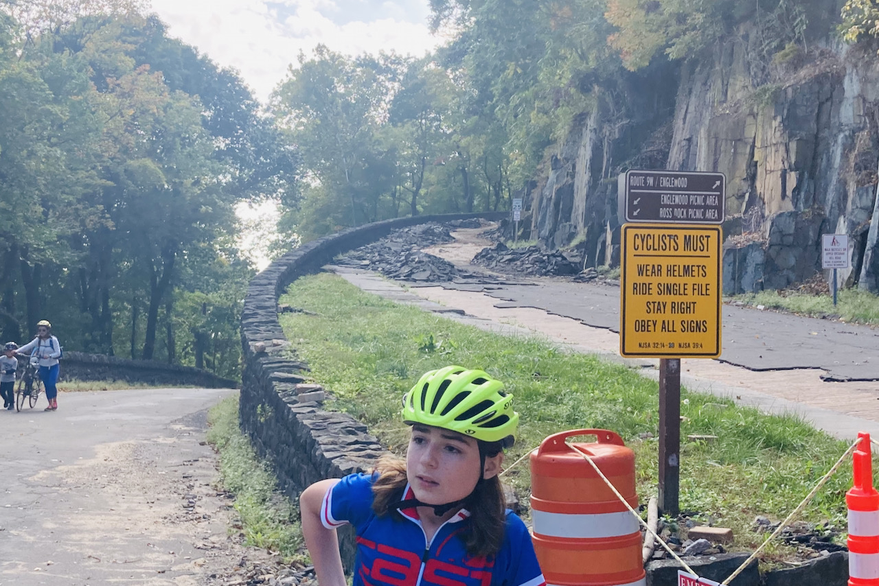
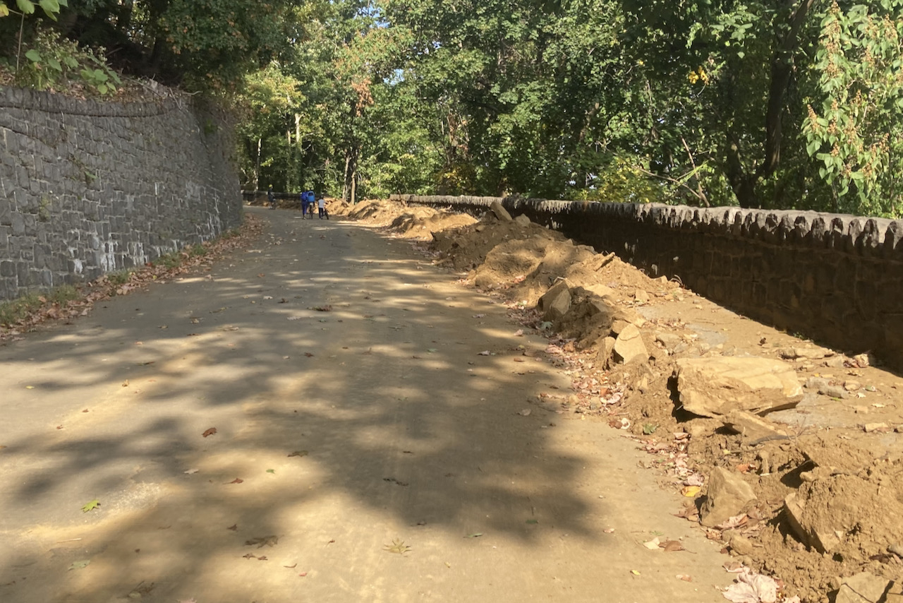
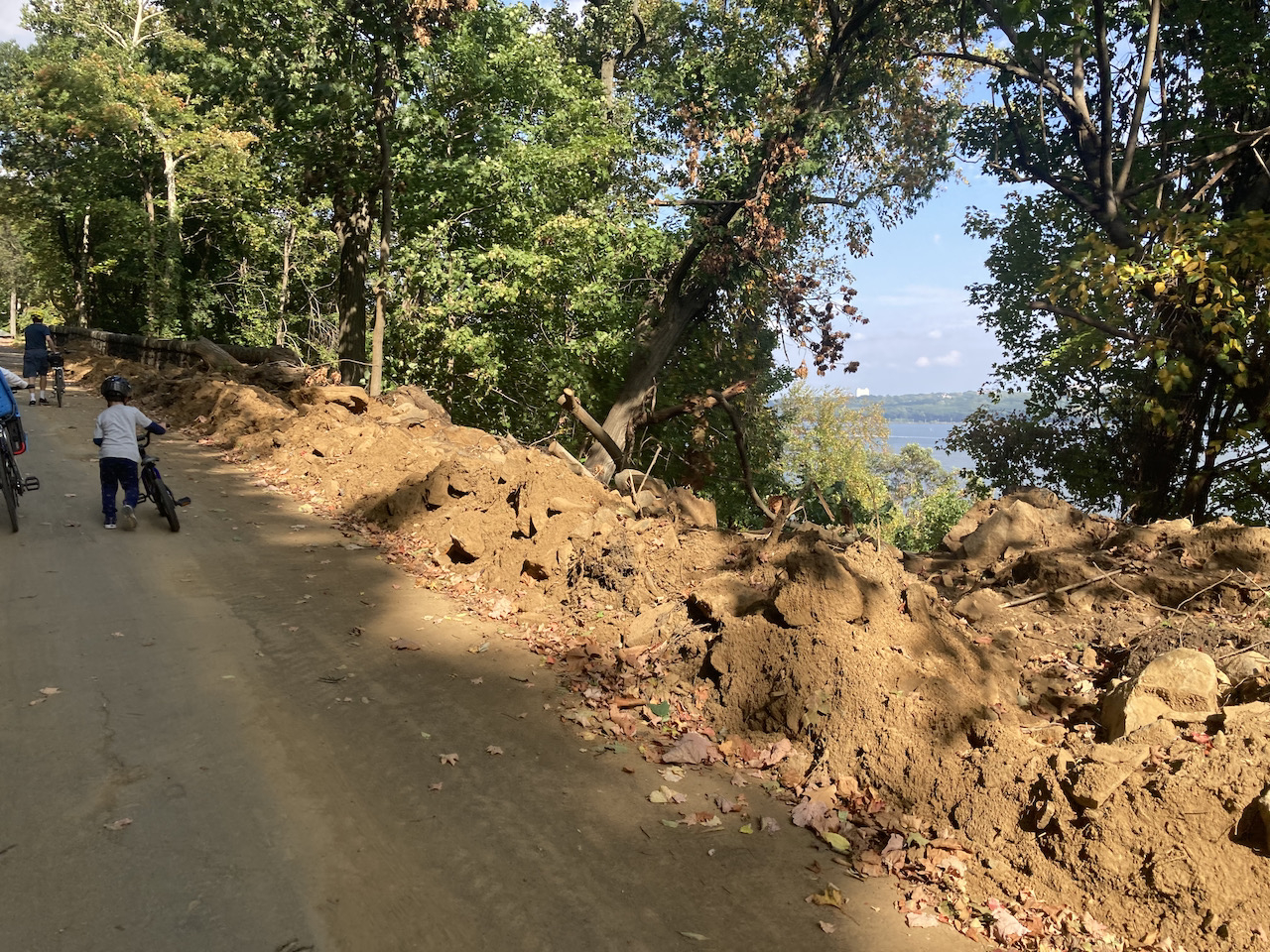
River road is still full of debris and downed trees. Ridable but not fun.
Went to River Road yesterday.

There were barriers across the entire road by the descent to the Ross Dock picnic area.  There was a park worker letting cars down only after a car left.

I didn't want to climb over the barrier in full view of a park employee who could call the police pretty easily.  

so I asked him.  "hey, can I ride north from here?"

He replied "It's officially closed" and air-quoted it.  

So I told him I wouldn't go.  And I definitely wouldn't crash.  

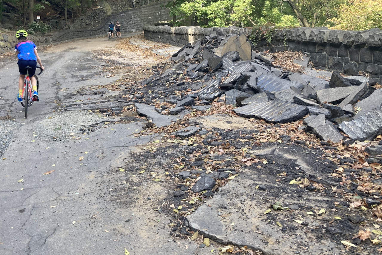
River Road is still a mess.  While you don't have to get off your bike from the Englewood Cliffs Boat Basin to the end, you still have to slow several times to avoid debris and trees left on the road.
Got on my fender commuter rig today (26x1.75" tires!) to assess the road conditions.

Not bad.

St. Nicholas Ave was narrowed and messy, as was Riverside and Adam Clayton Powell Blvd.  Car owners are dumping snow off their rides onto the road, further narrowing the road and often blocking the bike lane.  On St. Nicholas, some drivers have decided that they should angle park their cars.  And the NYPD doesn't seem to have a problem with it.

The GWB bike path is open!  It's messy, the messiest part of my ride today, but no ice on the pathway.  The hardest part is getting to the path on the NYC side.  The curb cut at 178th and Haven is blocked by a snowbank, so you're either carrying your bike over that or getting on at 177th and haven.

Central Park is clear and safe and very little water on the road.  The biggest danger is pedestrians who have decided that walking the same direction as bike riders in the middle of cycling lanes is the proper course of action, despite the fact that the walking/jogging lanes are also totally clear.

Just have to clean your bike after.
The NYC DCP has released a draft of their Comprehensive Waterfront Plan.

There is no velodrome, crit course or pump track planned.

But that doesn't mean we can't mount a concerted effort to get those added

Comment by May 28.  

Public Access issues begin on Page 19.

https://wheretobikenyc.com/2021/05/10/comment-on-the-nyc-waterfront-plan/
River Road is open again.

Not in great condition, but safe enough.  Lots of boulders that used to line the east side of the road dropped off into the abyss, and some rock walls went there as well.

The worst by far is the hill up past the Englewood boat basin.  As most people go north on it, it's plenty safe.


Holy Cow
I did River Road again today.

It's only for going slow right now.  

Seems like the last rain caused a tree to fall across the road. It's not huge, but there's no way around it, so you're stopping and dismounting and clambering over.

Furthermore, the rain also dumped a fair number of brick-sized rocks on the road. And in addition to the leaves, there are lots of branches and a fair amount of mud.
I rode around Harlem a bit this afternoon.  While I was on my fat-tire commuter, it was clear enough in most places for skinny road tires.

I'm thinking it should be ok for tomorrow and Sunday, provided it doesn't rain.
mugwump said:
I rode around Harlem a bit this afternoon.  While I was on my fat-tire commuter, it was clear enough in most places for skinny road tires.

I'm thinking it should be ok for tomorrow and Sunday, provided it doesn't rain.
19 degrees this morning 
Balmy
I went to Brooklyn today. 

Central Park is clear.  Prospect is clear.  The avenues are clear.  the Manhattan bridge is clear but narrowed.

The Brooklyn bridge was ok in the afternoon, but I'd be worried about it being icy tomorrow morning.  

Likewise, the west side path was pretty clear in places where there were no buildings to the west of it--as in clear from Stuyvesant to Chelsea Piers, then messy by the structures, and then clear again until the Intrepid, then clear again until you have to climb up to 79th.  

Did a lap in Prospect with ex-Kissena Dave Melchior.
The lower stretch of Prospect Park is as bad, probably worse than I've ever seen it. The prospect of racing on it in that condition is scary. Any word of repairs in the spring?
Be careful on the bk bridge bike path when it is below freezing at the sections where there is overhang from the promenade.  Water drains down from the promenade and they have not figured out a way to drain the bike lane, usually pretty icy. 
Central Park Update:  

the descent past the pool/rink and meer is closed and will be until around December 2, 2022.

From the Central Park Conservancy website.

"NOVEMBER 2022: To facilitate the construction of the new Harlem Meer Center, a portion of the East Drive just north of East 102nd Street to the Adam Clayton Powell Avenue entrance will be closed to all pedestrians, cyclists, and authorized vehicles starting Monday, November 14. The drive is expected to reopen by Friday, December 2. All traffic will be diverted at 102nd Street. Please follow the posted signs.
Thank you for your patience as we work to improve Central Park."

https://www.centralparknyc.org/restoration/harlem-meer-pool-and-rink
Rode over to Jersey today (12/26/22)

GWB is a little messy, but heavily salted.

9W has a few segments where the shoulders are just about completely iced over.
Looks like the GWB bike path on the south side will close next week, and the north side path will open.
How do you get to the north side path?
Is the north side new ? Do you still have to get off and walk?
@GregHoge You go to the first street north of the GWB and turn left.  It will lead you around to the path.

@Mark Taylor Yes, it's new.  It was originally slated to be completed sometime in 2021 I believe.  It is fully ramped, so you don't have to get off your bike.  The path around the towers is supposed to be wider, too.  And the fencing is taller and should prevent people from trying to jump (for those not aware, this was a real problem--between people jumping and threatening to jump, there was something like an incident nearly every other day the year before they put up all the hurricane fencing.)

It's not clear to me if this is a two-year-plus "temporary" route for everyone--because they've been planning to do the south side as well, and were waiting for the north side to be completed--or if it's temporary for pedestrians and permanent for cyclists.  

I'm feeling tired and I'm not reading well.  Here are two sites to see when it comes to figuring out what's coming up for the GWB

https://completegeorge.org/

https://www.panynj.gov/bridges-tunnels/en/george-washington-bridge/restoring-george-washington.html
Cool 
thanks for the insight 
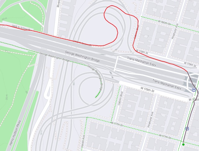
I rode the "Northwalk" bike path today.  It's a mixed bag.

The NY side has a different kind of lousy approach than the old south side path.  Here, you have to go on Fort Washington (assuming you're coming from Columbia-Presbyterian Hospital), and that takes you under the "tunnel" at Fort Washington between 178th and 179th.  Light is bad there, pavement is bad, and drivers are often anxious.  The left onto 179th is not good because it's right next to an entrance ramp to the GWB.  And the entry to the Northwalk itself doesn't have a no parking area and no big curb cut.

The new path is wider in places, but it still narrows too much by where the cables go under the upper level deck.  The path goes from 10' to 7' or less in these places. 

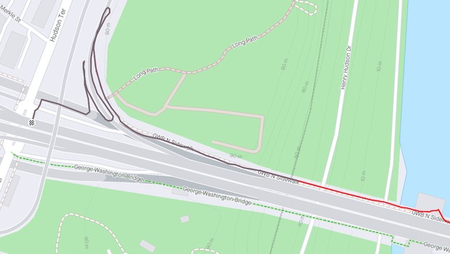
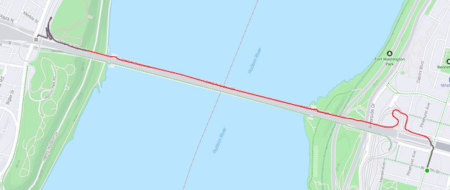
The Jersey side finale is complicated.  Three hairpins and you have to climb as well as descend.  I don't know if this could have been done any differently unless they were willing to blast and/or tunnel.  

I've attached some screen shots of the maps my ride files created.


Here's a news story from Streetsblog
https://nyc.streetsblog.org/2023/02/14/today-george-washington-bridge-northern-path-reopens-with-wider-entrance/

Here's an opinion piece on it.
https://nyc.streetsblog.org/2023/02/14/opinion-the-george-washington-bridges-revamped-bike-ped-paths-will-fail/
Thanks, JP. Typically NYC (i guess jerz gets half the blame) half-measure BS when it comes to cycling infrastructure.  Sad!  
The Central Park Conservancy has a survey on their site trying to gauge people's interest and concerns.

I suggest taking it.

  https://www.centralparknyc.org/drives