Kissena Forum Archive

Road & Bridge Conditions-H20, Dirt, Glass, Paving, Closures, etc

309 comments · 3345 views
utility work on the west drive in CP between 72nd traverse and TotG. 4 trenches, 1-2 feet wide and ~1 feet deep each, spanning the entire width of the road. Before 6am this morning they were hard to spot, especially because they were barely marked (single small orange cone on the side of the road). If you don't bunny hop them you will have a bad day. I saw an asphalt crew starting to mobilize towards the end of my ride so hopefully they'll be patched up soon. 
mostly paved by 11am.  


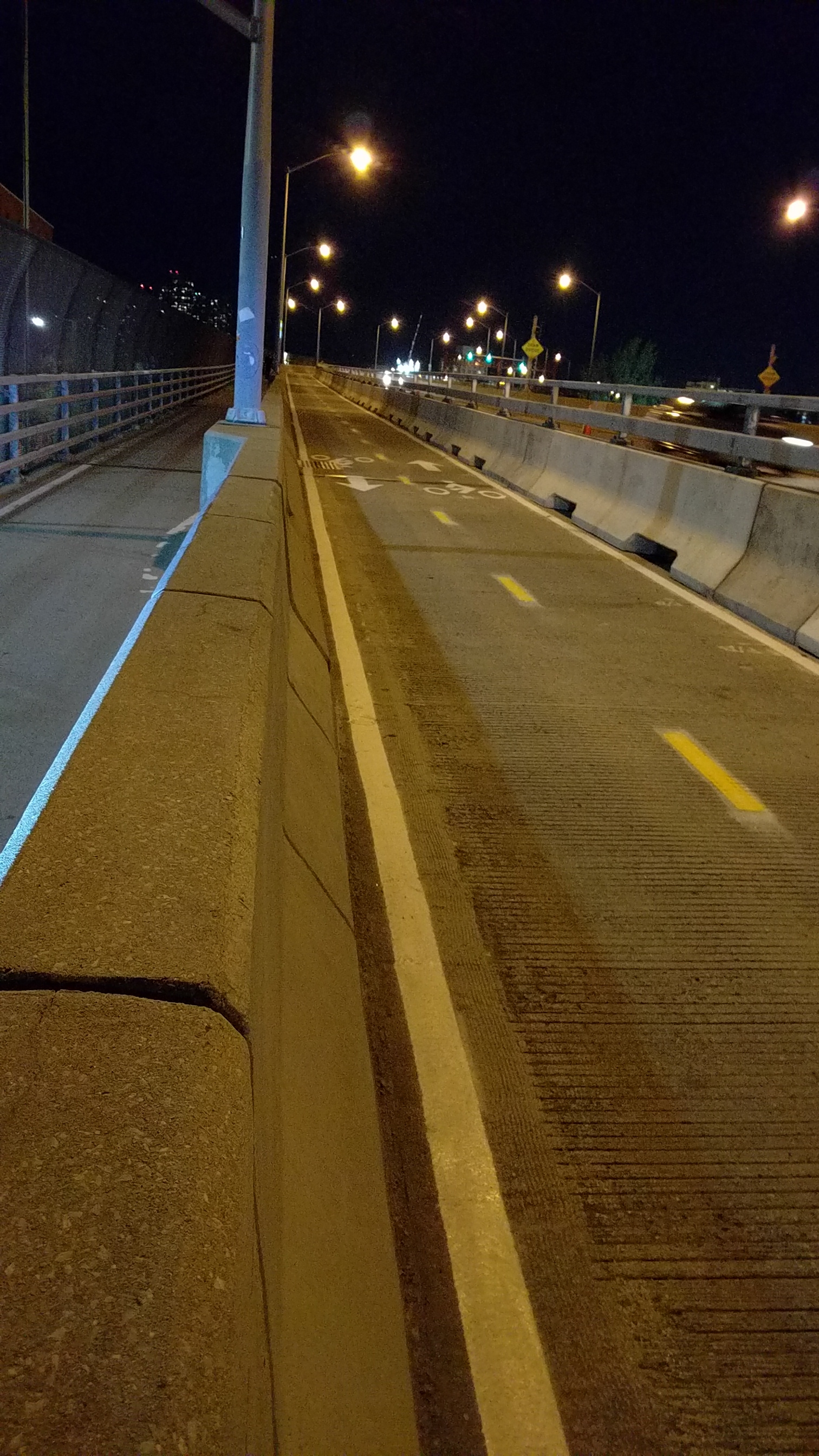
Pulaski bridge bike lane this evening.  Lanea are being marked..
it looks like a rumble strip.
What's the worst that could happen?

http://velonews.competitor.com/2016/04/news/rio-bikepath-collapses-into-sea-five-missing_403176
Where is the "horrified" badge?

http://www.streetsblog.org/2016/10/18/cb-7-parks-committee-votes-for-hilly-greenway-detour-in-riverside-park/

"Manhattan Community Board 7’s Parks and Environment Committee voted 4 to 1 last night in favor of the Parks Department’s proposal to route cyclists away from from Riverside Park’s waterfront greenway between 72nd Street and 83rd Street.

The plan would direct cyclists inland at 72nd Street through a hilly wooded path passing through the 79th Street Rotunda, which has a particularly steep incline. The justification is that the waterfront path is too crowded for cyclists and pedestrians to share, but the crowding is only a problem during peak summer months, and the detour would be in effect year-round. It is one of three similar detours in the department’s preliminary Riverside Park Master Plan."


It's been suggested that folks who oppose this plan attend the CB7 full board meeting this NOVEMBER 1

What: Meeting of CB7’s full board

When: Tuesday, Nov. 1, 6:30 pm (sign up to speak)

Where: Mount Sinai West Hospital (formerly Roosevelt Hospital), 1000 Tenth Ave. (at 59th Street).  Second floor.


But...the waterfront path is too crowded for cyclists and pedestrians to share. And a bicycle-only path through a hilly wood path sounds quite pleasant. Is the central concern of those who would oppose such a detour simply that the proposed bicycle-only path "has a particularly steep incline"? 
It's the fact that the path isn't crowded in the winter, and that the upper path is not only hilly, but darker and harder to clear of snow.

No small matter is that people already use the path for walking and running and it potentially just adds confusion and danger.

The desire of many is to make the cyclist detour seasonal only.  As in peak traffic summer months, mainly on weekends.
It seems to me that implementing a seasonal detour would cause more confusion than permanently re-assigning the upper path to cyclists.

Let's imagine that in addition to posting explanatory signs that many cyclists and pedestrians would ignore anyway, the Parks Department uses temporary barriers to divert cyclists to the upper path during summer weekends, much like how they currently divert southbound cyclists year-around from the esplanade to the inland pathway that runs past the basketball courts.

But then how do you make the upper path seasonally off-limits to peds? That seems considerably more difficult to accomplish, at least without some sort of barrier that would also require cyclists to dismount. I see a much worse outcome for cyclists: the esplanade impassable and peds wandering, whether deliberately or obliviously, onto the upper bicycle path.

As for lights, the Streetsblog report JP linked to notes that even with a fraction of their ideal budget, the plan includes LED lights for the bike path.

Snow and ice present hazards to cyclists, to be sure, but why not work to convince the department to invest in the relatively minimal additional manpower necessary to keep the upper path clear during the worst of winter, instead of opposing what seems like a generally sturdy plan on the assumption that it can't or won't do so?

Ultimately, I'm still feeling out this issue. My political baseline, however, is that New York City belongs to pedestrians, and that bicycle riding, while fun and healthy, is not the panacea for the city's problems that it is often heralded to be. Unfortunately a number of other cycling-related groups that I'm a part/aware of seem ready to dig in their Giro-soled heels and defend the current arrangement, to which I am longing for an alternative. 
That section can get crowded.  Unfortunately, that routes the cyclists away from the bathrooms, though walking or riding slowly to them shouldn't be an issue.

I think this is part of the growing pains of recognizing more riders on bikes.  I'm all for more dedicated bike paths, if this is what it's to become.  People walk, run, walk their dogs, tourists walk along that stretch and except for early mornings, it does become crowded and dangerous and I dislike the ride back from the GWB because of it.  There are also a couple of patches of cobbles that often force one onto one extreme side or another, and fences that jut out from the marina, squeezing people together.

If there's a clear path for bikes, and marked for them, I'm happy to ride them, and won't consider it a detour.  One season of riding that new path and people will know not to walk on it.  Anything to get me away from someone pointing to NJ and clocking me in the face as I ride by.

I find it bizarre they're taking action on this, though, when we really need a dedicated car lane on the Brooklyn Bridge.
I appreciate the concerns posted here, and frankly if you don't like the proposal, please take action.

Personally, when I see the proposed path, I think it is better than what it is now.

In fact, often, on my rides back, I ride part of the proposed path to avoid the waterfront.

(sidenote: who designs these things? why would you make both the new and old path a green dashed line?!? omg)
I ride that route approximately every day now on my commute on the way home.  It is not at all crowded at ~630PM on weeknights (especially now that it's colder and windier).  But during the summer it's a shitshow.

I'm fine with a diversion.  That section is bumpy and has those gates opening onto it.  It's bad as it is now there's not even really a line indicating bike lane v pedestrian lane, truly shared and no good for anyone.

Separated bike lanes not shared  with pedestrians are great, we can go faster without being inconsiderate or endangering the odd escaped child that darts in front of us.  

Even if they build the detour I'm sure some folks will opt not to take it unless they install anti-bike spikes or something :)


Even if they build the detour I'm sure some folks will opt not to take it unless they install anti-bike spikes or something :)
There is the enforcement matter, if nothing else.

That bridge from 83rd to 95th for example.  It was supposed to be for bikes only when it was built, at least according to what I heard/read.  

To me, I think there is a reasonable concern that the detour will be problematic in winter, even with lights installed.  And the hill,unless graded, is taking away from the utility of the greenway--should it be so steep that some cyclists need to walk it?   Any uphill one direction means a downhill in the other, and those who concerned about speed being dangerous will have added a section where extra speed is possible.

I don't think seasonal will be any more confusing that a permanent detour.

Yes, walking is important.  At the same time, the west side greenway was envisioned as such because it kept cyclists away from everyone else.  When everyone else finds the cool bike route, cyclists are then told they need to go elsewhere because they shouldn't be around everyone else.  

There needs to be a better solution.
I'm more concerned about the several mile stretch of Queens Boulevard service road that I ride daily with no bike lane. My chances of injury there are a lot higher than the West side bike path unless they reroute it onto 9A
Here's the lazy way to protest the proposed changes


https://campaigns.transalt.org/petition/cyclist-access-uws-greenway
Went over to Englewood and Tenafly for some climbing fun this morning.  I went out when the fog was heavy enough to be just short of drizzle.

Then the sun came out and started to dry the roads.  As I was riding in Englewood on a residential street, I noticed that the left side of the road was covered in oil.  Glad I was going the other way.  Then I turned left, and the oil was covering both sides of the road. 

Lazy car owners.  
River Road all the way through is open for business. Just biked it, hit the gaurd station, etc. Still closed to cars but good for bikes and walkers. Cops are fine w it.
River Road is closed today and tomorrow for repaving.

5/20 at 10PM to 5/21 10AM the south side of the GW will be closed, you can still cross but on the north side of the bridge, which involves 172 stairs.
River Road is closed today and tomorrow for repaving.

5/20 at 10PM to 5/21 10AM the south side of the GW will be closed, you can still cross but on the north side of the bridge, which involves 172 stairs.
I'm guessing the "repaving" has to do with GFNY.  Assume they're filling in some holes, but getting out their signage and promotional stuff.
some CP loops this morning revealed some long awaited pot-hole fillings on harlem hill. Most of the particularly bad section most of the way up is covered, which is nice. however it seems like the steamroller driver didn't get the memo, so at the moment the filling actually rises an inch or two above the road surface. there's also some loose asphalt pebbles/debris scattered around the area. i give the job a C-. however it's better than having holes! maybe the fillings will settle? i'm optimistic.  
GwB south side closed 9.25 to the end of 2017. Bummer. North side will be open so hope you all like stairs. 
I'm not going to lie, this is a welcomed closure. 

http://www.lohud.com/story/news/local/rockland/orangetown/2017/10/08/south-nyack-river-road-shutdown-begins-tuesday/739553001/
South Side of the GWB was OPEN today.


Could be worth going.  
Here's a drawing of the proposed redesign of the bike/ped ramps on the NY side of the GWB.

https://www.panynj.gov/photo/bridges-tunnels/restoring-george-178th_179thStreetRamps.jpg
mugwump said:
Here's a drawing of the proposed redesign of the bike/ped ramps on the NY side of the GWB.

https://www.panynj.gov/photo/bridges-tunnels/restoring-george-178th_179thStreetRamps.jpg
The current setup is an embarrassment for the city of NYC. JP, is there an article or post that better explains what's in the image?
eloy said:
mugwump said:
Here's a drawing of the proposed redesign of the bike/ped ramps on the NY side of the GWB.

https://www.panynj.gov/photo/bridges-tunnels/restoring-george-178th_179thStreetRamps.jpg
The current setup is an embarrassment for the city of NYC. JP, is there an article or post that better explains what's in the image?
Not much better.  Here's the main page.   You can also find drawings of how they're going to redesign the landings on the Jersey Side.

https://www.panynj.gov/bridges-tunnels/restoring-the-george.html
Some of you may already know this but the NYC Marathon is this Sunday. Expect road closures in Brooklyn (morning until about noon) and Manhattan (all day). Plan accordingly.